Section 1: Minehead to Bude
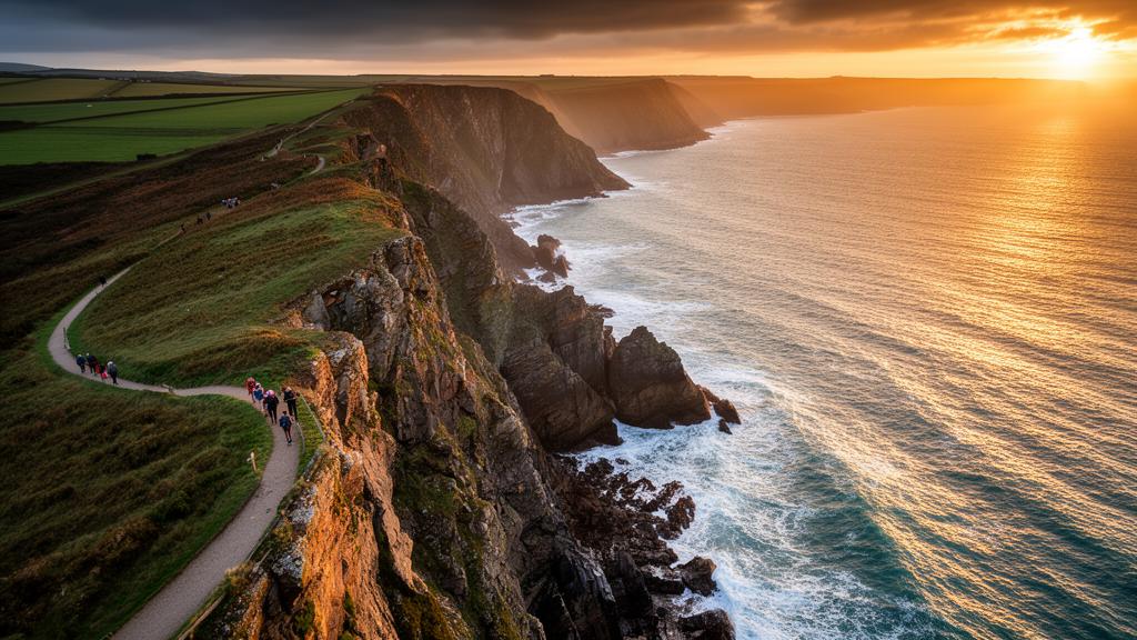
The route begins at Minehead's seafront and wastes no time in testing your legs, climbing steeply through North Hill woodland before reaching England's highest coastline, with clifftops rising to 250 metres above the Bristol Channel. Early highlights include panoramic views across to Wales from near Selworthy Beacon and the picturesque thatched hamlet of Bossington. The path then drops to Porlock Weir's historic harbour before ascending again through ancient Culbone Wood, where gnarled oaks form a cathedral canopy overhead. Just beyond sits St Beuno's Church, reputedly England's smallest complete parish church, tucked into the hillside and barely changed since pre-Norman times.
The section through Devon's Exmoor coast is consistently spectacular. At Great Hangman, standing at 318 metres, you reach both England's highest sea cliff and the highest point on the entire South West Coast Path, with Exmoor's moorland rolling away behind you and the Bristol Channel glittering below. The descent into Lynmouth's pretty harbour is a prelude to Lynton's clifftop drama, and the path onwards through Woody Bay, Heddon Valley, and the wild headlands of Trentishoe and Holdstone Down rewards every step with extraordinary views.
Beyond the sheltered resort of Ilfracombe, the character of the walk shifts again. Morte Point, notorious for the shipwrecks it has claimed over centuries, gives way to Woolacombe's magnificent three-mile golden beach and the geological curiosity of Baggy Point, where Barricane Beach receives Caribbean shells washed in on the Atlantic currents. The route then passes through Braunton Burrows, a vast dune system where American forces trained for the D-Day landings, before reaching Barnstaple and following the traffic-free Tarka Trail along the Taw and Torridge estuaries through Instow and Bideford.
The final stretch from Bideford to Bude is arguably the most demanding of the entire section. After passing through the iconic cobbled fishing village of Clovelly, reached via the magnificent Hobby Drive carved through wooded slopes by Napoleonic prisoners, the path reaches the wild clifftops around Hartland Quay. From here to Bude the walking becomes relentless, with steep descents to river mouths followed by punishing climbs back to the clifftops, repeated again and again across terrain that many consider the toughest on the entire path. En route you'll cross from Devon into Cornwall at Marsland Water before the path finally eases across the grassy headland above Bude and drops down to Crooklets Beach.
This is a section of enormous variety, from gentle wooded combes to savage open cliffs, and it will take most walkers ten to fourteen days to complete comfortably.
Section 2: Bude to St Ives
Leaving Bude, the second section of the South West Coast Path heads south and then east along Cornwall's rugged Atlantic coast, eventually rounding the toe of the county and arriving at the celebrated fishing port and artists' haven of St Ives. It is a long and demanding walk of well over 200 kilometres, but one that passes through some of the most varied and historically rich scenery in England.
The opening miles set an immediate tone of challenge and reward. The cliffs around Widemouth Bay and Millook Haven are geologically extraordinary, their folded Carboniferous rocks creating vivid zigzag patterns in the cliff face that draw geologists from across the world. The valley crossings become increasingly punishing as you approach Crackington Haven, where one particularly brutal descent requires 180 steps down to sea level before an equally demanding climb back out. High Cliff, at 223 metres the tallest cliff in Cornwall, looms above the aptly named Strangles beach shortly beyond, and the waterfall at Pentargon plunges 37 metres into an inaccessible cove below.
The path then reaches Boscastle, its narrow harbour tucked into a winding inlet, before heading on to Tintagel with its legendary castle perched on a wave-battered island and connected to the mainland by a striking modern bridge. The castle's Arthurian associations draw visitors from around the world, but the coast path itself needs no mythology to justify the detour. From Tintagel the route crosses seven steep valleys before dropping to Trebarwith Strand's golden beach and eventually reaching the beautifully preserved fishing village of Port Isaac, known to millions as the setting for the television series Doc Martin.
Beyond Port Isaac the path rounds the Rumps headland, site of an Iron Age promontory fort, and passes the memorial to poet Laurence Binyon who wrote For the Fallen on the cliffs at Pentire Point in 1914. The route then reaches the Camel Estuary, where a short ferry crossing from Rock to Padstow is the only practical option. Padstow itself is a highlight of the entire walk, a handsome harbour town with an excellent food scene and a pleasant contrast to the wild clifftops surrounding it.
South of Padstow the character of the coast gradually softens. The path passes Trevose Head lighthouse, the dramatic rock stacks of Bedruthan Steps, and the long sandy arc of Watergate Bay before reaching Newquay, Cornwall's surf capital. The mining heritage of mid-Cornwall then takes centre stage, with the clifftops around St Agnes offering one of the path's most striking industrial landscapes, the ruined engine house of Wheal Coates standing against the sky as a reminder of the communities that worked this coast for centuries. This stretch forms part of the Cornwall and West Devon Mining Landscape World Heritage Site.
The final miles ease considerably, following long sandy beaches past Perranporth and Hayle before the path rises over the headlands above St Ives Bay and descends into St Ives itself. It is a genuinely satisfying finish, the cobbled lanes, galleries, and clear turquoise water of the bay offering a welcome and well-earned reward at the end of a demanding and magnificent walk.
Section 3: St Ives to Falmouth
The third section of the South West Coast Path leaves the sandy beaches of St Ives Bay behind and strikes west into some of the wildest and most ancient landscape in Britain. By the time it reaches Falmouth, it has taken in Land's End, the Lizard Peninsula, and a remarkable variety of coastal character, from granite headlands and mining ruins to sheltered fishing coves and subtropical creek-side woodland.
The walk begins with a demanding stretch of clifftop path heading west from St Ives toward Zennor and beyond, where dramatic granite cliffs plunge into clear turquoise water and the Atlantic stretches away to the horizon. This is remote, exposed country with few facilities, and the detour inland to Zennor, with its ancient quoit and its pub dating to 1271, is well worth taking. Further west the path passes close to the extraordinary industrial heritage of Pendeen and Botallack, where tin and copper mines once drove tunnels beneath the seabed. The engine houses of Botallack, perched at the very edge of the cliffs, are among the most dramatic and evocative industrial ruins in England, and form part of the Cornwall and West Devon Mining Landscape World Heritage Site.
Cape Cornwall, England's only true cape, marks a significant landmark before the path reaches Whitesand Bay and Sennen Cove, a working fishing village looking out across one of Cornwall's finest beaches. From here it is a short walk along the clifftops to Land's End itself, the most southwesterly point of mainland Britain, where the Atlantic and the English Channel meet in a restless churn of water around the offshore rocks. The path then turns east, passing the remarkable natural arch at Nanjizal and the clifftop Minack Theatre carved into the rock above Porthcurno, before rounding the Logan Rock headland and dropping into the tiny, perfectly preserved fishing hamlet of Penberth Cove.
Mousehole, Newlyn, and Penzance follow in quick succession along Mount's Bay, with the iconic silhouette of St Michael's Mount growing steadily larger as you walk east. The tidal island castle, accessible on foot at low tide, is one of Cornwall's most recognisable landmarks. Beyond Marazion the path rounds Cudden Point, passes Prussia Cove with its smuggling history, and follows the clifftops past the restored engine house of Wheal Prosper before arriving at Porthleven, Britain's most southerly working harbour.
The Lizard Peninsula brings a complete change of atmosphere. The path crosses the remarkable Loe Bar, a sand and shingle barrier sealing off Cornwall's largest freshwater lake from the sea, then reaches Gunwalloe and the extraordinary Church of St Winwaloe, the only parish church in Cornwall built directly on a beach. Kynance Cove, with its white sand, serpentine rock stacks, and rare Cornish heath, is one of the most beautiful spots on the entire South West Coast Path, and the red-billed choughs tumbling on the thermals overhead are a reminder that this headland supports wildlife found nowhere else in Britain. Lizard Point, mainland Britain's southernmost tip, is reached shortly after.
The path then heads north and east through Cadgwith, a thatched fishing village where the pub still hosts traditional sea shanty nights, and continues along the eastern shore of the Lizard past the halfway point of the entire South West Coast Path at Porthallow, marked by a granite sculpture on the shingle beach. River crossings at Gillan Creek and the Helford River require careful timing around the tides or seasonal ferry services, and the wooded creekside paths around Helford provide a gentle and atmospheric contrast to the open clifftops that have come before. The section concludes at Falmouth, a handsome harbour town with a busy waterfront and the formidable Pendennis Castle guarding the headland above.
Section 4: Falmouth to Plymouth
The fourth section of the South West Coast Path begins with a ferry crossing and ends with another, bookending a walk of tremendous variety through the quieter, lesser-known stretches of Cornwall's south coast before arriving at one of England's great naval cities. Between Falmouth and Plymouth the path passes through some of the most unspoilt and rewarding coastal scenery on the entire route.
The crossing of the Carrick Roads from Falmouth to St Mawes sets the tone immediately, the ferry passing between the twin Tudor castles that Henry VIII built to guard this magnificent natural harbour. From St Mawes a second, smaller ferry hops across to Place, and the path proper begins at St Anthony Head, where a lighthouse built in 1835 stands among extensive Second World War gun emplacements and the views back across the estuary mouth are outstanding. The walking south through the Roseland Peninsula is consistently beautiful, passing through Portscatho and around the broad sweep of Gerrans Bay before the stiff climb to Nare Head, at 90 metres the dominant viewpoint of this stretch, with its Bronze Age barrows and wartime decoy installations. The descent into Portloe, a tightly clustered fishing village around a narrow quay, is one of the section's highlights.
Beyond Portloe the path reveals one of its more surprising moments, the Gothic Revival towers of Caerhays Castle rising above the sandy beach at Porthluney Cove, a castle designed by John Nash in 1808 and set within grounds containing botanical collections of national importance. The climb to Dodman Point follows, the highest headland on Cornwall's south coast at 114 metres, crowned by a granite navigation cross and ringed by the earthworks of an Iron Age promontory fort whose ramparts stretch for nearly a kilometre. On clear days the views extend from the Lizard to Devon. Gorran Haven and Mevagissey provide welcome refreshment stops before the path navigates the challenging stretch to Charlestown, a remarkably preserved Georgian harbour town whose quayside regularly appears as a filming location and where tall ships still lie at anchor.
The path then crosses the wide sandy expanse of Par Sands, with the china clay works providing an incongruous industrial backdrop, before rounding Gribbin Head with its striking red and white striped daymark tower. The woods and coves around here carry strong associations with Daphne du Maurier, who lived nearby for two decades and drew on the landscape for Rebecca. Fowey, reached after a final descent through woodland, is one of the most attractive towns on the entire path, its deep water harbour busy with yachts and its narrow streets full of good places to eat and stay.
A short ferry across to Polruan begins what many consider the most physically demanding stretch of the section. The cliffs above Lantic Bay and Pencarrow Head involve relentless steep ascents and descents, and the approach to Polperro, one of Cornwall's most photographed fishing villages, is hard-won. Looe and Seaton follow before the path reaches the military firing range at Tregantle, where red flag warnings may force a diversion, and the dramatic headland of Rame Head with its medieval clifftop chapel. The twin villages of Cawsand and Kingsand, former smuggling centres with handsome Regency architecture around a sheltered bay, provide the final stop before the path winds through the woodland and formal gardens of Mount Edgcumbe Country Park.
The section concludes with a ferry crossing of the River Tamar into Plymouth, where The Hoe, with its sweeping views across Plymouth Sound and Smeaton's Tower standing on the waterfront, provides a fitting and memorable finish to the entire Cornish coast.
Section 5: Plymouth to Exmouth
The fifth section of the South West Coast Path leaves Plymouth's historic Barbican, passing the Mayflower Steps where the Pilgrim Fathers departed for the New World in 1620, and heads east along Devon's varied and rewarding coastline to the Exe Estuary. A short ferry option across Plymouth Sound gets walkers quickly clear of the city and onto the dramatic clifftops above Jennycliff Bay, where views back across the Sound toward Cornwall are outstanding. The Victorian fortress of Fort Bovisand, one of Palmerston's coastal defence follies, marks the transition to rugged cliff walking around Andurn Point before the path settles into the gentler landscape around Wembury Bay, where the Great Mew Stone sits half a mile offshore and the Old Mill Café occupies a converted watermill at the beach.
The crossing of the Yealm Estuary by seasonal ferry brings walkers to Noss Mayo, one of South Devon's most attractive villages, its cottages tumbling to the water's edge. Beyond the estuary the path follows the Victorian Revelstoke Drive along dramatic clifftops, with the terrain opening up above rocky coves and headlands before a tidal crossing of the River Erme demands careful planning around the tides. The sandy beach at Bigbury-on-Sea and the famous tidal island of Burgh Island, with its Art Deco hotel that inspired Agatha Christie, make this stretch particularly memorable. A further seasonal ferry across the River Avon leads to the thatched village of Bantham.
The path then rounds Bolt Tail, its Iron Age earthworks still visible on the headland, and continues along the cliffs to Soar Mill Cove, a secluded beach accessible only on foot and known for its extraordinary mica schist rock formations. The section around Bolt Head is among the most dramatic on the entire Devon coast, the narrow Courtney Walk cut from the cliff face in the nineteenth century providing a vertiginous traverse above the sea. After a descent through woodland to the sailing town of Salcombe, another ferry crosses the estuary to East Portlemouth, from where the path continues to Prawle Point, Devon's most southerly headland, and past the haunting ruins of Hallsands village, destroyed by a storm in 1917 after offshore shingle extraction undermined its sea defences.
The character of the walk changes completely at Slapton Sands, where the path follows a narrow shingle bar between the sea and Slapton Ley, England's largest natural freshwater lake and an internationally important nature reserve supporting over 180 bird species. A Sherman tank monument at Torcross commemorates Operation Tiger, the 1944 D-Day rehearsal in which hundreds of American soldiers were killed by German boats. The beach at Blackpool Sands, tucked beneath wooded cliffs with brilliant turquoise water, provides one of the section's finest rest stops before the path rounds the Dart Estuary and reaches the handsome medieval town of Dartmouth, accessed from the far bank at Kingswear via a short ferry.
The final miles pass through Brixham, Berry Head with its vast guillemot colony and Britain's shortest lighthouse, and the resorts of Paignton and Torquay before the path follows the famous sea wall railway line to Dawlish and the Exe Estuary, concluding with a ferry crossing from Starcross to Exmouth.
Section 6: Exmouth to South Haven Point
The sixth and final section of the South West Coast Path begins at Exmouth's esplanade and concludes at South Haven Point on the edge of Poole Harbour, completing Britain's longest National Trail at 644 miles. It is a fitting finale, traversing the entire Jurassic Coast World Heritage Site and passing through some of the most geologically extraordinary and scenically dramatic coastline in England.
The walk begins gently enough, climbing to Orcombe Point where the Geoneedle sculpture marks the official start of the Jurassic Coast, the red sandstone cliffs here preserving ancient desert deposits laid down 250 million years ago. Budleigh Salterton and Sidmouth follow before the path reaches Branscombe Mouth, where a striking anchor from the 2007 wreck of the MSC Napoli marks the transition from red sandstone to white chalk, and the landscape shifts into the haunting Hooken Undercliff, a collapsed world of chalk pinnacles and dense vegetation created by an eighteenth-century landslip. Beer and Seaton provide welcome stops before the path enters the Axmouth to Lyme Regis Undercliffs National Nature Reserve, seven kilometres of dense, humid woodland growing over one of the largest active landslide systems in Western Europe, justifiably described as Britain's closest equivalent to a tropical rainforest.
Lyme Regis, famous for Mary Anning's pioneering fossil discoveries, marks the crossing into Dorset and a change in the character of the coast. The climb to Golden Cap at 191 metres, the highest point on England's entire south coast, rewards with views stretching from Dartmoor to the Isle of Portland. West Bay follows, its golden sandstone cliffs familiar to millions as the backdrop to the television drama Broadchurch, before the path reaches one of the walk's most remarkable stretches, the eighteen miles of Chesil Beach. This extraordinary natural shingle barrier, with its pebbles graded perfectly by size from west to east, backs the Fleet Lagoon, a brackish tidal lake of international importance for wildlife. The path leaves the beach at Abbotsbury, home to Europe's largest colony of nesting mute swans.
A circuit of the Isle of Portland, reached by causeway, takes in the open-air sculpture park at Tout Quarry and the distinctive red and white banded lighthouse at Portland Bill before the path returns to Weymouth and continues east along spectacular chalk downlands. Durdle Door, the perfectly formed limestone arch carved by centuries of wave action, is one of England's most photographed coastal features, and Lulworth Cove's horseshoe bay is equally iconic. The section through the Lulworth Military Range beyond requires careful planning around access restrictions, but rewards with the Fossil Forest, Worbarrow Bay, and the approach to Kimmeridge, with its shale cliffs and remarkable museum of Jurassic marine life.
The final miles along the Isle of Purbeck are outstanding, passing Dancing Ledge, the Norman chapel at St Aldhelm's Head, Winspit Quarry, and the extraordinary Great Globe at Durlston Country Park before reaching Swanage. The path then climbs to Old Harry Rocks, three dazzling white chalk stacks marking the easternmost point of the Jurassic Coast World Heritage Site, and descends to Studland before following the beach at Shell Bay to its conclusion at South Haven Point, where the official monument marks the end of one of the great long-distance walks in Britain.