

OpenAir

    Your Self-Guided Adventure Starts Here

    Create Your West Highland Way Route Itinerary

    Choose your options below to create a personalised day-by-day plan.
    Stops are based on access to accommodation.

    1

    Choose your Direction

    2

    Choose your Pace

    3

    Choose your Start Date

    Select your date to start the West Highland Way.

    4

    Choose your Daily Hours

    Total Moving Time
    51h 23m
    Hours Per Day8h
    Easy (4h)Standard (8h)Long (12h)
    Your Journey
    8days

    Based on an average of 8 hours on the trail per day

    5

    Generate Your Instant Free Itinerary

    • โœ… No log-in required
    • โœ… See a zoomable map of all the stages
    • โœ… You'll see your full day-by-day plan instantly
    • โœ… Ability to adjust stops, add rest days
    • โœ… Accommodation directory for every stop
    • โœ… Downloadable West Highland Way GPX files
    • โœ… Save your plan as PDF

    Want this trip booked for you?

    Big Trail Adventures arranges the whole trip, so all you have to do is walk.

    • Hand-picked places to stay along the way
    • Bags carried to your next stop each day
    • Built around your pace and dates
    Big Trail Adventures

    OpenAir Tools is built by the team behind Big Trail Adventures, who run hosted group departures and premium self-guided holidays on these trails.

    Free West Highland Way GPX Route Files

    Download free GPX files for the West Highland Way, split by day to match your personal itinerary. Our planner generates individual GPX tracks for each of your stages, from Milngavie through the bonnie banks of Loch Lomond and across Rannoch Moor to Fort William.

    Each GPX file includes full elevation data and follows your chosen direction of travel. Load them onto Komoot, AllTrails, Garmin, OS Maps, or any GPS-compatible device. No sign-up required โ€” just generate your itinerary and download.

    KomootAllTrailsGarminOS MapsMaps.meApple Watch

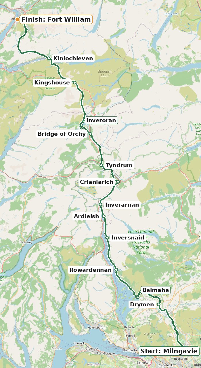
    West Highland Way route map

    Map of the West Highland Way route from Milngavie to Fort William
    The 154 km (96 miles) West Highland Way runs north from Milngavie, past Loch Lomond and across Rannoch Moor, to Fort William. Map data ยฉ OpenStreetMap contributors.

    To see a detailed interactive map and GPX downloads, click the Generate Itinerary button above.

    West Highland Way key places and distances

    Main places on the West Highland Way from Milngavie to Fort William, with distances
    PlaceDistance from startDistance to next place
    Milngavie0 km18.9 km
    Drymen18.9 km11.6 km
    Balmaha30.5 km13 km
    Rowardennan43.5 km10.9 km
    Inversnaid54.4 km6.7 km
    Ardleish61.1 km3.8 km
    Inverarnan64.9 km9.5 km
    Crianlarich74.4 km9.3 km
    Tyndrum83.7 km10.8 km
    Bridge of Orchy94.5 km4.1 km
    Inveroran98.6 km15.6 km
    Kingshouse114.2 km14.3 km
    Kinlochleven128.5 km24.7 km
    Fort William153.2 kmFinish

    Frequently Asked Questions


    How Long Does the West Highland Way Route Take?
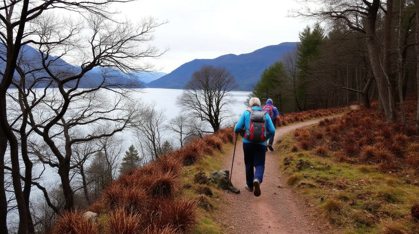
    Hikers on the West Highland Way with Loch Lomond and Highland mountains in the background

    The West Highland Way stretches approximately 154 km (96 miles) from Milngavie on the outskirts of Glasgow to Fort William at the foot of Ben Nevis, passing through some of Scotland's most spectacular Highland scenery. How long it takes depends entirely on how you choose to travel it. Based on averaging 8 hours a day on the trail, here's what to expect.

    Most walkers complete the route in 7 to 8 days, averaging around 12 to 14 miles per day with comfortable overnight stops in villages and towns along the way. This is the classic pace โ€” unhurried enough to soak in the stunning Highland scenery, enjoy a pub meal at the end of each day, and still feel the satisfying pull of progress through glens and along lochs.

    For those who move light and fast, fastpacking the West Highland Way in around 5 days is a popular challenge. Covering 19 to 20 miles a day with a stripped-back pack, fastpackers experience the route with a different kind of intensity โ€” longer days on the trail and bigger transitions between landscapes. It demands fitness and good navigation, but the sense of momentum is addictive.

    At the sharp end, experienced trail runners tackle the entire route in as few as 4 days, running significant distances daily across some of Scotland's most beautiful terrain. It's a serious undertaking that combines endurance, mountain skills, and mental resilience, but for those with the legs and the drive, it's one of the great trail running challenges in the Scottish Highlands.

    Our planner lets you adjust daily hours and speed profile to find the perfect schedule for however you choose to travel. Whether you're planning a relaxed week or a four-day push, we'll build you a day-by-day itinerary that fits.
    West Highland Way Route โ€” Sample Itineraries

    Four sample route itineraries based around 8 hours of walking per day, south to north from Milngavie to Fort William. Use these as a starting point, or create your own custom plan above.

    9-Day Explorer Route Itinerary

    Take your time and savour every mile of Scotland's most famous trail

    The Explorer pace is ideal for walkers who want to truly soak in the scenery, stop for photos, visit viewpoints, and arrive at each day's accommodation with energy to spare. At around 3.5 km/h with generous breaks, this 9-day self-guided itinerary gives you the most relaxed experience of the West Highland Way route.

    153 kmTotal distance
    3,122mTotal ascent
    View full 9-day route

    8-Day Hiker Route Itinerary

    The classic route at a steady walking pace

    The most popular way to walk the West Highland Way route. At around 4 km/h with regular breaks, this 8-day self-guided itinerary is ideal for reasonably fit walkers who want a good daily challenge while still having time to enjoy the scenery and arrive refreshed at each day's accommodation.

    153 kmTotal distance
    3,122mTotal ascent
    View full 8-day route

    5-Day Fastpacker Route Itinerary

    Covering more ground each day with a lighter pack and stronger legs

    For fit, experienced walkers who want to push the pace. Averaging 5 km/h with minimal breaks, fastpacking this self-guided West Highland Way route delivers bigger daily distances and a genuine sense of momentum. It demands fitness and good navigation, but the reward is completing Scotland's most famous trail in under a week.

    153 kmTotal distance
    3,122mTotal ascent
    View full 5-day route

    4-Day Trail Runner Route Itinerary

    A long-weekend blitz for experienced endurance athletes

    The self-guided West Highland Way route in four days is a serious undertaking โ€” 35โ€“45 km per day across some of Scotland's most demanding terrain. It combines endurance, mountain skills, and mental resilience. Carry light, move fast, and experience one of the great trail running challenges in the UK.

    153 kmTotal distance
    3,122mTotal ascent
    View full 4-day route

    What to Expect on the West Highland Way Route

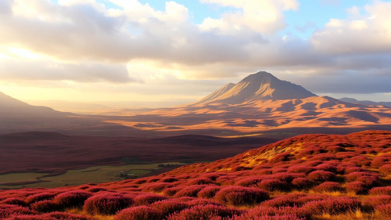
    Rannoch Moor and Buachaille Etive Mor from the West Highland Way, heather moorland with dramatic Highland scenery

    Starting from the granite obelisk in the center of Milngavie, just north of Glasgow, the West Highland Way covers 154 km (96 miles) of some of Scotland's most varied and dramatic landscapes. It is the country's most famous long-distance trail, and for good reason. Over the course of seven to nine days, walkers are carried from the suburban fringes of a great city into the heart of the Highlands, finishing beneath the shadow of Ben Nevis in Fort William.

    The early stages ease you in gently. The path rolls through woodland, parkland, and farmland, passing the historic Clachan Inn in Drymen, reputedly Scotland's oldest licensed pub, before the first real test arrives at Conic Hill. The climb to 361 meters may not be enormous, but the reward is spectacular โ€” a sweeping panorama of Loch Lomond and its scattered islands, with Ben Lomond rising to the north. This is also the line of the Highland Boundary Fault, and crossing it feels fitting. The Lowlands are behind you.

    The next section traces the eastern shore of Loch Lomond through ancient oak woodland, passing waterfalls and rocky promontories, with the loch glittering through the trees. The going becomes progressively rougher north of Inversnaid, where boulder fields and twisted roots demand care and attention, but the wild beauty of this stretch more than compensates. Rob Roy's Cave sits tucked into the lochside rocks, a reminder that these hills have long fired the imagination.

    Beyond the loch, the trail follows the River Falloch north, then climbs through forestry and open hillside before descending toward Tyndrum and Bridge of Orchy. The mountains are growing larger now. Beinn Dorain's distinctive conical summit dominates the skyline for miles, and the stone bridge at Bridge of Orchy, dating from 1751, is a fine place to pause and take stock of how far the landscape has changed since Milngavie.

    The crossing of Rannoch Moor is the moment many walkers remember most vividly. One of the largest and most exposed blanket bogs in Europe, the moor stretches away in every direction under huge skies, with distant peaks breaking the horizon and the great pyramid of Buachaille Etive Mor rising ahead. It is genuinely remote, and genuinely magnificent.

    From the Kingshouse Hotel, the trail climbs the Devil's Staircase, a switchback ascent to the highest point on the entire route at 550 meters, before descending into Kinlochleven. The final day pushes through the remote Lairig Mor valley, past Iron Age ruins and beneath the Mamores ridge, before the forest tracks give way to Glen Nevis and the outskirts of Fort William. The official finish is marked by a statue of a seated walker in Gordon Square, a figure that seems to capture perfectly the mix of exhaustion and satisfaction that most people feel when they arrive.

    The West Highland Way is challenging in places, but it is well-marked and well-served with accommodation and refreshment stops throughout. It is a route that rewards those who take the time to walk it properly.


    Best Time to Walk the West Highland Way Route

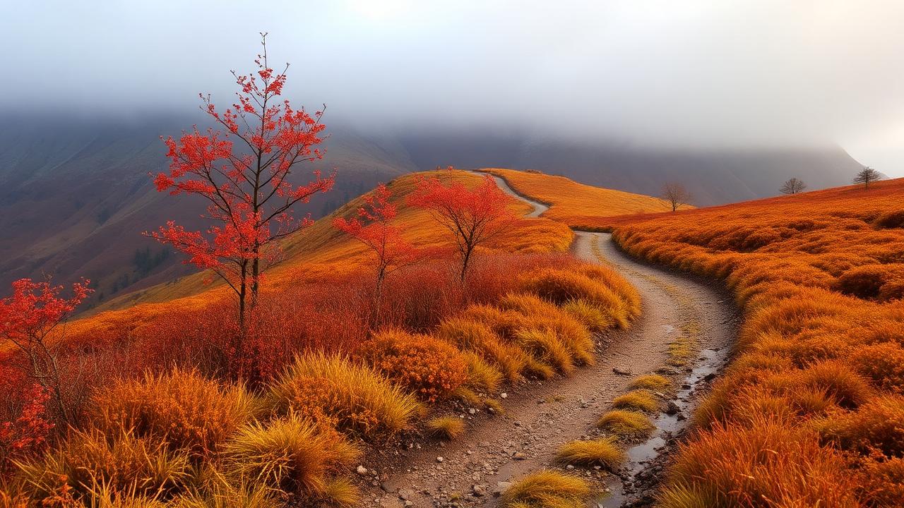
    West Highland Way trail in autumn with golden bracken and red leaves in the Scottish Highlands

    The West Highland Way sits in one of the wetter corners of Europe, and walkers should be prepared for rain at any time of year. The weather in the Scottish Highlands is famously changeable, and a single day can bring sunshine, cloud, wind, and heavy showers in rapid succession. Waterproofs and layered clothing are essential regardless of when you travel.

    Spring, from April to early June, brings longer days and quieter trails, but snow can still linger on higher ground and the paths can be muddy. Summer, July and August, offers the best chance of warm, settled weather, but this is also peak midge season. These tiny biting insects thrive in still, damp conditions and can make rest stops genuinely unpleasant, particularly in sheltered woodland and around the lochside sections. A good midge repellent and a head net are strongly advisable from June through September.

    Autumn is arguably the finest time to walk, with bracken turning gold and red, fewer midges, and often stable weather through September and into October. Winter walking is possible but demands experience and the right equipment, as short daylight hours, ice, and severe conditions on exposed sections like Rannoch Moor can make the route genuinely serious.

    "If you're able to, add an extra day. Allow room for the unexpected."
    Read Jennifer Stevens' blog about the first time she walked the West Highland Way.

    Getting There / Transport

    How do I reach the start in Milngavie?

    Milngavie is just 8 miles north-west of Glasgow city centre and is very easy to reach by public transport.

    ๐Ÿš† By Train

    The easiest and most popular option. Trains run from both Glasgow Queen Street and Glasgow Central (Low Level) to Milngavie every 15โ€“30 minutes throughout the day. The journey takes around 23โ€“25 minutes and costs around ยฃ4. The start of the West Highland Way is well signposted from Milngavie station. If arriving in Glasgow from elsewhere in the UK, regular services connect from London Euston, Edinburgh, Manchester, and Birmingham into Glasgow.

    ๐ŸšŒ By Bus

    There are regular bus services from Glasgow city centre to Milngavie, taking around 30โ€“40 minutes. If arriving by air, frequent shuttle buses connect Glasgow International Airport to Glasgow Central station, where you can pick up the train to Milngavie.

    ๐Ÿš• By Taxi

    A taxi from Glasgow city centre to Milngavie takes around 15โ€“20 minutes and costs approximately ยฃ15โ€“ยฃ30. Uber also operates in Glasgow.

    How do I get back from Fort William?

    Fort William is well connected by rail, bus, and coach, making the return journey straightforward from most UK cities.

    ๐Ÿš† By Train

    The scenic West Highland Line runs from Fort William directly to Glasgow Queen Street, taking around 3 hours 45 minutes to 4 hours 30 minutes. Services typically run once or twice a day โ€” check ScotRail for current timetables and book in advance where possible. From Glasgow you can connect onward to Edinburgh (around 50 minutes), London Euston (around 4.5 hours with Avanti West Coast from Glasgow Central), and other UK destinations.

    ๐ŸšŒ By Coach

    Scottish Citylink operates frequent coach services from Fort William to Glasgow (around 3 hours) and Edinburgh, with stops along the route at Glencoe, Bridge of Orchy, Tyndrum, and Crianlarich โ€” useful if you want to do the trail in sections. Ember, a newer electric coach operator, also runs services linking Fort William with both Glasgow and Edinburgh airports.

    ๐Ÿš• Private Transfer

    Several operators offer private return transfers from Fort William back to Milngavie or Glasgow, which is especially convenient if you left a car at the start. This can be booked through luggage transfer companies and other local providers โ€” worth considering if you want to avoid the train timetable entirely.

    Our Other Trail Itinerary Planners

    We have free itinerary planners for 20 long-distance trails across Europe. Each one includes custom pace settings, day-by-day schedules, and downloadable GPX files. Visit openair.tools to explore them all.

    England

    Scotland

    Scotland / England

    Wales

    France / Italy / Switzerland

    Italy

    Spain

    Portugal